|
Where: Gungarre
Monsoon Walk: - South Alligator River
Area
Features:Kakadu Resort is surrounded by Gungarre Monsoon
Forest and the billabong walk takes you through a monsoon
forest, along the edge of a billabong and finally through
fringing woodlands. The chance to see flora and Aboriginal
use of plants from the three habitats, monsoonal vine forest,
floodplain and woodland. The walk is open all year round,
is 3km.
Allow: 1.5 hours.
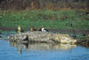
Where: Mamukala Wetlands -
Nourlangie Area
Features:
Mamukala is a wetlands observation platform with well presented
information. Viewing isall year round, it is at its most dramatic
in the late Dry Season, when thousands of Magpie Geese congregate
to feed on the Mamukala Wetlands. Choose from a 1km to 3km
trail and walk to see these wetlands. Open all year round
and entry is free.
Allow: 1.5 hours.
Where: Mirrai
Lookout Walk - Nourlangie Area
Features:
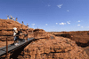
Mirrai Lookout walk, 30 kilometres south of
the Bowali Visitor Centre, is in the Nourlangie Area. The
walk takes you to a platform lookout on Mount Cahill. Around
3.6 kilometres return, the walk involves a steep climb, making
it more difficult than most.
Allow:
2.5 hours.
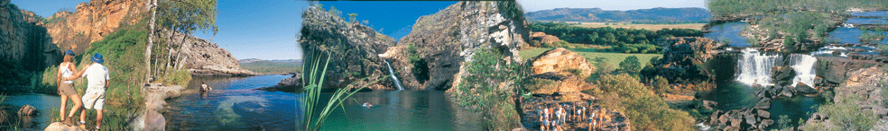
Where: Ubirr -
East Alligator Region:
Features: There are currently four hiking trailas and
walking tracks, ranging from the comfortable1 km walk graded
easy at Ubirr.
Allow: 1 hour.
Where: Ubirr
- East Alligator Region:
Features: There is also a 8 km wilderness hike that
can take over 3 hrs return through escarpment along the East
Alligator River.
Allow: 4 hours.
Where: Sandstone
and river bushwalk -
East Alligator Region:
Features: (dry season only) Starts off the Bardedjilidji
walk located in the Ubirr Area (See East Alligator Area link).
An easy 6.5 km marked circular walk which takes you past Catfish
Creek, floodplains, billabongs, sandstone outliers and the
East Alligator River. The Bardedjilidji walk leads to the
rocky outcrops of Arnhemland and is one of Kakadu's best short
walks at just over an hour to complete comfortably.A recommended
attraction.
Allow: 4 hours.
Where: Nourlangie
Rock - Nourlangie Area
Features:This art site is a flat 4 km, up to 2hr walk
from Nourlangie Rock. The fact that the access road is very
corrugated and doesn't get tour buses means the art site sees
fewer visitors. Nanguluwur includes images from the Contact
period when Aborigines first encountered explorers and settlers.
Allow: 2 hours.
Where: Barrk
bushwalk - Nourlangie
Area
Features:This marked walk branches off the Nourlangie
Rock lookout track, just past the Main Gallery (see Nourlangie
Area link). A 12 km difficult walk through the sandstone country
of Nourlangie, past the Nanguluwur art gallery and back to
the car park. See the Barrk Walk Park Note.
Allow: 6 to 8 hours.
Where: Barrk
Marlam Bushwalk - Jim
Jim Falls Area
Features: (dry season only) This marked day walk branches
off the Jim Jim Falls Plunge Pool track (see Jim Jim Falls
Area link). A difficult 6 km return through the rugged stone
country typical of the Arnhem Land Plateau.
Allow: 6 to 8 hours.
Where: Budjmi
Lookout - Jim Jim Falls
Area
Features: Starts at the Day Use / Picnic Area near
the Jim Jim Creek crossing. A 1km return walk to the top of
a rocky outcrop which provides great views of the escarpment
cliffs.
Allow: 1 hour.
Where: Jim
Jim Falls Plunge Pool -
Jim Jim Falls Area
Features:Jim Jim Falls Plunge Pool A 2km return walk
through monsoon forest and over boulders will take you to
a deep plunge pool surrounded by spectacular, 150-metre high
cliffs. This walk is suitable for people who are fit and can
manage uneven terrain (large boulders, often slippery). Visitors
who choose to swim at the Jim Jim Falls plunge pool do so
at their own risk. Please note the visitor safety page regarding
crocodiles and all crocodile warning signs on site. Do not
enter the water downstream of the Jim Jim Falls plunge pool.
Estuarine crocodiles may be present.
Allow: 1 to 2 hours.
Warnings - External
Link On Crocodiles, Swimming in pools and gorges, Disease-carrying
insects, Large feral animals, Dehydration, Lost or injured
group members, Wildfires, Flash flooding, Emergency telephone
numbers.
Resources
• www.parksandwildlife.nt.gov.au/
• www.environment.gov.au/parks/
• www.facebook.com/RoadReportNT
• www.roadreport.nt.gov.au/
• www.ntlis.nt.gov.au/roadreport/
• www.toiletmap.gov.au/
• www.travelnt.com/
Warnings -
Please note sometimes the main link from the government database
is replaced if so here is the start of the Parks section and
please subsearch for crocoidle warngs etc.
Where: Twin
Falls Plateau Walk
Features:Twin Falls Plateau Walk This is a steep and
challenging 6-kilometre return walking trail to the plateau
above Twin Falls. The highlights make the challenge worth
it - stunning views across the Park and swimming in the pools
along the creek. A permit is required from the Bowali Visitors
Centre.
Allow: 3 to 4 hours.
Where: Yurmikmik
Walks
Features:Yurmikmik Walks This series of interconnected
walking tracks in the southern part of the Park take walkers
to waterfalls and swimming holes. Many walks are open all
year round including the Boulder Creek Walk, Yurmikmik Lookout
Walks and Motor Car Falls.
Allow:
Where: Mirrai Lookout Walk
Features:Mirrai Lookout Walk This moderately difficult
3.6km return walk departs from the Mirrai carpark, 30kms south
of the Bowali Visitor Centre. The walk goes to the Mount Cahill
lookout and after a steep climb you'll be rewarded with unparalleled
views of the Kakadu escarpment.
Allow: 1.5 hours.
|